Land, Water, and Human Interactions | NGSS

Issues and Science, Third Edition, Redesigned for the NGSS
Which areas of Boomtown are the best choice for construction?
Students construct explanations based on evidence for how geoscience processes have changed Earth’s surface. They will model how water cycles over and under the surface and through the air and have opportunities to apply scientific principles to design systems that can reduce the human impact on land and water.
Students generate and answer questions such as: How do earth processes, like wind and flowing water, change Earth’s surface? How do human activities change Earth’s surface?
Details at a Glance
- 5-7 Weeks | ~50 minute class periods
- 16 Activities
- Accommodates 5 classes, each with 8 groups of 4 students
- Consumables service 160 students
- Includes Spanish student materials
- Meets our criteria for supporting literacy
- Includes digital resources
- Developed in partnership with SEPUP & The Lawrence Hall of Science
- Includes assessment
Teacher Materials
-
#SMS-IMP-3000NC
-
#SMS-3ROLTP-6
-
#SMS-IMP-3RTE
Student Access
-
#SMS-IMP-3RSB
-
#SMS-3ROLSP-6
Additional Unit Materials
-
#CART-CUSTOM
-
#SLN-1
-
#SMS-IMP-3RSBS
-
#SMS-IMP-3HD
-
#SMS-IMP-3HB
Evidence of Alignment
Issues and Science was developed at the Lawrence Hall of Science in response to the need for high quality, three dimensional, phenomena driven curriculum. Quick details from this unit:
- Anchoring phenomenon: The landscape is constantly changing due to natural processes and human activity.
- Investigative phenomena within the 16 activities connect content to the unit issue, Which areas of Boomtown are the best choice for construction?
- This unit builds towards and assesses Performance Expectations (PE) ESS2-2, ESS2-4, ESS3-3, ETS1-1, ETS1-2.

Program Components
Lab-Aids programs combine components to make a system for learning. Learn more about each of the four components below.
What comes with my unit materials?
Equipment for all Unit Activities
Includes a complete set of materials for one of 17 units of study. Our complete equipment package supports up to 5 classes of 32 students.
Download the Itemized ListOnline Teacher Portal License
The Online Teacher Portal is the most common way to access the Teacher Edition. The 6 year license includes Spanish versions, LABsent, editable PowerPoints, Teacher Edition, Student Book, and supplemental resources. Teacher Editions are also available in print.
Learn More About the Online PortalWhat are the options for student access?
Student portal access is not included in the Complete Equipment Package to keep purchasing options flexible. You have the option of purchasing printed student books, online student access, or both.
Student Book
Hardbound, high-quality student books are designed to last the length of an adoption for use year after year. Unlike a traditional texbook, the Student Book does not provide science content through reading and questions. Instead students are encouraged to question, investigate, and analyze in each of the heavily field-tested activities.
Online Student Portal License
Request a quote
The online student portal is optional but highly recommended. Here students will find access to Remote Learning Activities in case of an absence, support tools like ReadSpeaker with translation, and can have direct communication with the teacher (for schools who want this feature).
Learn More About the Online PortalAdditional Unit Materials
If you need hard copies or additional supplies, we provide a suite of materials designed to supplement and support your complete package.
Need to order refills for this Unit?
Issues and Earth Science | Second Edition
Order RefillsLand, Water, and Human Interactions | NGSS
Order RefillsRelated Products
-
 Kit #485SEngineering and Design: Reducing Shoreline Erosion
In this engineering design activity students start by modeling the erosive effect of ocean waves on a sea cliff. They then design an erosion-reducing barrier and test it to observe how well it reduces the cliff erosion. They then use their experience with the cliff model to design, test, and redesign structures to limit...
$320.90 View Details -
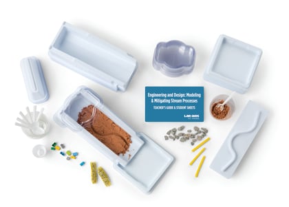
Kit #446SEngineering & Design: Modeling & Mitigating Stream Processes
Students model the phenomenon of sediment movement in a river to gather evidence for how geoscience processes change Earth’s surface. In Part A, students investigate how flowing water erodes and deposits sediments to create common landforms. Part B is an engineering design challenge where students use design criteria and constraints to design...
$333.70 View Details -
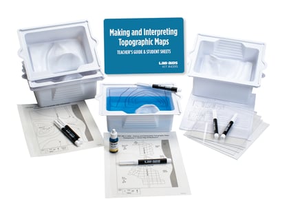
Kit #439SMaking and Interpreting Topographic Maps
This activity provides students with a basic understanding of topographic maps and how to interpret them. Students use a three-dimensional plastic model of landscape to construct a two-dimensional topographic map. This experience provides students with a better understanding of what contour lines represent and how to interpret them.
$121.50 View Details -
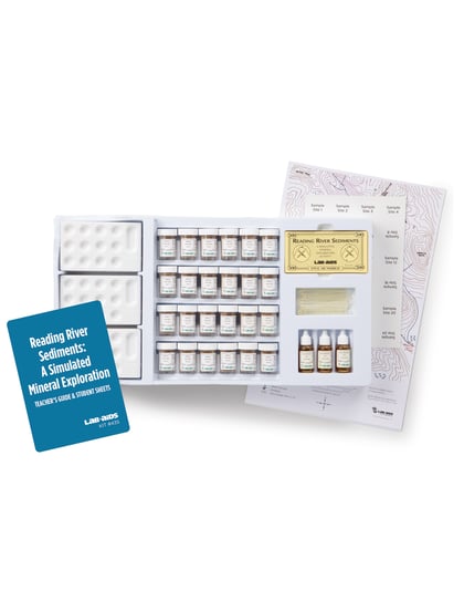
Kit #435Reading River Sediments
Part 1 introduces or reviews the features and interpretation of a topographic map. In Part 2, students use geochemistry to help locate mineral deposits. They choose 10 (of 24 possible) simulated soil samples to test for the “concentration of molybdenum.” They use their results to try to determine the location of the molybdenum ore deposit. They...
$245.00 View Details